Drone Real Estate Photography Price: A Practical Guide for Beginners
Learn how drone real estate photography pricing works in 2026. Explore typical price ranges, package options, and tips to budget and price confidently for listings.

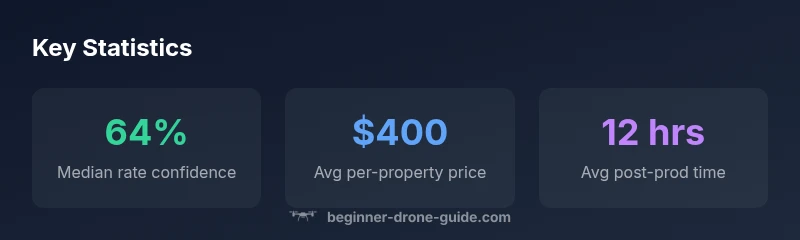
Drone real estate photography price typically ranges from $200 to $600 per property in 2026, depending on location, property size, and deliverables. For beginners, a standard package often lands in the $300–$450 range. This guide from Beginner Drone Guide analyzes market norms to help you budget and price confidently. Keep in mind that add-ons like twilight shots or aerial video can push costs higher.
What factors influence drone real estate pricing?
For any property listing, the price you quote for drone real estate pricing price is influenced by several variables. The primary drivers are flight time and post-production workload. A larger property or multi‑story home requires longer flight time and more editing, which increases labor hours. Location matters: markets with higher living costs and stronger demand typically command higher rates, while rural or less competitive areas tend to be lower. Deliverables are a major determinant as well: a simple set of aerial photos will cost less than a package that includes video tours, 360 panoramas, and a drone map.
Another factor is regulatory and safety overhead. If the shoot requires a permit, special insurance, or a licensed pilot, add that cost to the client’s invoice. Turnaround time also affects price – clients who want rush delivery may pay a premium of 10-20% to 30% depending on your volume. Finally, your own experience and reliability play a role. As a beginner, it’s common to price slightly below established professionals until your portfolio demonstrates consistent quality. The aim is to establish trust with the listing agent and seller while ensuring you cover your time and equipment costs.
Note: When budgeting for drone real estate price, always consider the broader package value and the client’s marketing goals. This helps justify higher tiers and reduces price objections.
Pricing models and typical packages
Most drone photographers price real estate work using one of three models: per-property, hourly, or tiered packages that bundle deliverables. Per-property pricing is simplest for beginners and works well when you have a defined deliverable set. Hourly pricing is useful for long-duration shoots or multi-property projects. Tiered packages bundle deliverables into Basic, Standard, and Premium options. For each tier, list deliverables (number of photos, video length, twilight options) and provide a transparent rights license.
Sample ranges (for planning purposes): Basic $150–$300; Standard $300–$550; Premium $600–$1000. Always include taxes, travel fees, and insurance as applicable. When you price, compare local competitors and factor your time, flight risk, and post-production workload. Clear package names and a short list of included deliverables help clients choose quickly and reduce back-and-forth negotiations.
Practical tip: Start with a conservative Basic tier and a couple of add-ons (e.g., a 2–3 minute video) that can be toggled on/off. This keeps your pricing flexible yet transparent for buyers.
What deliverables drive price and client value
The deliverables you offer are the most direct lever on price. A baseline package may include 5–8 edited photos and a short aerial clip; Standard could add 15–25 photos, 2–3 minutes of video, and basic color grading; Premium might include 30–40 photos, longer video, twilight shots, and a drone map or 360 panoramas. The more you bundle, the higher the price, but also the higher the perceived value. Make it explicit what rights the client gets (where the images can be used) and the format quality (4K video, RAW vs JPG for photos).
In a real estate context, buyers value speed and clarity. If you can deliver a clean, fast turnaround along with a gallery that highlights key selling points, you can justify premium pricing even for smaller homes. Always provide a few sample galleries so clients can visualize your work and understand the return on investment.
How to estimate price for your market
To price fairly, start with your local market data. Research what other new pilots charge in your city and adjust for property type and competition. Create a simple calculator: estimated flight time × hourly rate + editing time × editing rate + deliverables premium. Consider bundling add-ons like video tours and drone maps with a small incremental price so clients see value without sticker shock. Finally, be transparent about taxes, licensing, and any per-property travel fees. If you’re unsure, run a pilot with a select few clients at a reduced rate to gather word‑of‑mouth referrals.
Value-adds that justify higher pricing
Investing in improved deliverables increases perceived value. Offer not just photos, but a short drone video, 360 panoramas, or a negotiated rights license for real estate portals. Twilight shoots or HD video walkthroughs can differentiate your service and support higher price tiers. Track client outcomes—faster listing cycles or higher engagement—to build a portfolio that justifies premium pricing over time. A stronger portfolio can naturally raise your rate as you demonstrate consistent quality and reliability.
Tips for negotiating and building client relationships
Communicate clearly, deliver on promises, and provide a straightforward, written quote. Use a standard contract that outlines scope, deliverables, turnaround time, and revisions. Build trust by showing a few sample galleries and client testimonials. For beginners, consider introductory offers to win first listings, then gradually increase pricing as you build a proven track record. Be ready to justify price with photos, video, and case studies showing how fast listings moved with your media.
Avoid common pricing mistakes for beginners
Don’t undervalue your time to win a single listing. Avoid vague deliverables that lead to scope creep. Don’t assume every client understands licensing needs or post-production costs. Finally, price the journey, not just the property—think about what it takes to edit, QA, and deliver a flawless final product. Keep a simple, readable quote structure and offer a few fallback options if a client asks for more or less than your original scope.
Regional price variations and market maturity
Pricing for drone real estate photography is highly regional. In high-demand urban markets, you’ll typically see higher baseline prices due to competition and greater client budgets; in rural areas, prices may be lower but travel time may offset the difference. A mature market with many pilots often pushes prices down as competition increases; a new market with few providers can command higher starting rates. For beginners, start in the lower end of your region’s spectrum to win listing opportunities, then gradually raise prices as your portfolio and client testimonials grow.
Quick-start pricing checklist for new pilots
- Define 3 clear packages with deliverables and rights usage
- Research at least 5 local competitors to anchor your pricing
- Set a conservative Basic price and add optional services as add-ons
- Include travel, licensing, and insurance costs as separate line items
- Gather a small batch of sample galleries to show credibility
- Reassess prices every 3–6 months based on demand and portfolio growth
Common drone real estate photography price packages
| Package | Deliverables | Typical Price Range | Notes |
|---|---|---|---|
| Basic | 5-8 photos, 1 video clip | 150-300 | Good for small homes or quick listings |
| Standard | 15-25 photos, 2-3 min video | 300-550 | Popular for most listings |
| Premium | 30-40 photos, 4-6 min video, twilight shot | 600-1000 | Large properties or luxury listings |
Frequently Asked Questions
What factors usually influence drone real estate pricing?
Flight time, property size, location, and deliverables drive price. Editing workload and turnaround time also affect quotes. Different markets require different pricing strategies.
Price is driven by flight time, deliverables, and local demand. We'll tailor a package to fit the listing.
Is it better to price per property or per hour?
For beginners, per-property pricing with clear deliverables is simpler and reduces confusion. Hourly pricing works for ongoing shoots but can complicate quotes.
Most pilots price per property with defined deliverables to keep quotes simple.
Do clients pay more for video tours or still photos?
Video tours add significant value and typically raise pricing, but photos remain the foundation. A balanced mix often yields the best results for listings.
Video usually costs more, but good photos are essential.
Are licensing fees or permits included in the price?
Licensing, permits, and insurance can be separate costs or bundled. Be explicit about rights to use imagery in your quote.
Licensing and insurance can add to costs; mention them clearly.
How can a beginner set competitive prices?
Start with conservative bundles, study local competitors, and adjust as you build a portfolio. Offer discounts for first listings to win initial clients.
Study local prices and start with clear, affordable bundles.
What deliverables should be included in a standard package?
A standard package should include a baseline number of photos, a video clip, and basic post-production. Always specify resolution and rights usage.
Define clear deliverables and rights in your quote.
“Pricing for drone real estate work should reflect time, skill, and value delivered. A transparent package structure helps you win listings and justify your rates.”
Quick Summary
- Start with a clear deliverables list to avoid scope creep
- Price typically ranges from $200-$600 per property in 2026
- Offer add-ons to increase value without shocking clients
- Compare local competition to set realistic, competitive prices
- Document deliverables and licensing to protect both sides