Drone Over Texas: A Beginner's Guide to Safe Flying
Learn how to fly a drone over Texas safely and legally with a step-by-step guide. Cover airspace, licensing, local rules, weather planning, permissions, and safety practices for urban and rural areas.

Direct answer: You can legally fly a drone over Texas by following FAA rules, verifying airspace, and respecting local ordinances. This guide lays out a step-by-step approach for safe, compliant flights, including licensing or registration if required, insurance considerations, and practical tips for urban, rural, and park areas statewide. Understand weather planning, local enforcement nuances, and how to obtain permissions for controlled events.
Why Flying a Drone Over Texas Requires Thoughtful Preparation
Texas offers diverse flight environments—from vast open plains to dense urban corridors—making a well-planned approach essential when you fly a drone over texas. According to Beginner Drone Guide, the safest outcomes come from understanding airspace, local ordinances, and practical risk management. For new pilots, this means building a habit of researching your exact takeoff location, scanning for temporary flight restrictions, and acknowledging that state and municipal rules can differ widely. The phrase drone over texas evokes a spectrum of contexts: a quiet rural farm, a windy border area, or a city park with family activity. Each scenario demands different considerations: altitude, visibility, people nearby, and proximity to airports. By starting with a strong plan, you minimize hazards, protect privacy, and stay within the law. This article helps you translate curiosity into safe, legal practice across diverse Texas environments.
Understanding Airspace in Texas: From Class G to Controlled Areas
Airspace around Texas airports can range from uncontrolled Class G to controlled Class B, C, or D zones close to major hubs. Before you fly, confirm the exact class at your takeoff point using FAA UAS Facility Maps and, if eligible, LAANC authorizations. The phrase drone over texas underscores the need to tailor your flight to the surrounding airspace: rural ranchlands may be permissive, while near cities or airports you’ll need clearances. Always verify NOTAMs and temporary restrictions, especially during events or construction. Mastery here reduces risk to people and property and helps you avoid federal enforcement actions. This section equips you to interpret airspace data and apply it to real Texas environments.
Key Regulations You Must Know Before Flying in Texas
All drone pilots must follow federal rules when flying over texas. Recreational flyers should adhere to FAA guidelines, maintain visual line of sight, and register if required; commercial pilots must hold a Part 107 certificate and may need waivers for specific operations. Local rules vary by city and park, so check municipal ordinances before takeoff. The safety-first mindset means preparing a flight plan, logging your device’s registration (if applicable), and respecting privacy and consent in populated areas. If you plan to fly in a high-risk zone, pursue the appropriate waivers early and document approvals. This groundwork prevents surprises and keeps you aligned with both federal and Texas-specific requirements.
Practical Flight Scenarios: Rural, Urban, and Park Areas
When planning a flight in Texas, consider three broad contexts: open rural land, dense urban cores, and public parks. In rural settings, you can establish longer flight lines and test camera angles with fewer restrictions, provided you respect private properties and livestock. Urban environments demand heightened situational awareness, anti-collision discipline, and clear discussions with property owners or event organizers when filming. Park flights often invoke additional restrictions—many parks ban drones unless explicitly permitted. In all cases, keep your altitude conservative, avoid flyovers of people, and prepare a robust risk mitigation plan. The ta-da moment for successful drone operations over texas comes from adapting to each location’s constraints while keeping safety and consent at the forefront.
Equipment, Registration, and Insurance Considerations for Texas Flights
Your toolkit should include a properly registered drone, a charged controller, spare batteries, and a reliable wind/temperature monitoring plan. Registration is required for many hobby and commercial drones, and proof of registration may be requested by authorities in Texas. Insurance is not mandatory, but it helps cover damages and liability concerns, especially when flying near property or crowds. Always bring any documentation that proves compliance with FAA rules and local regulations. For the experienced flyer, a simple pre-flight checklist boosts confidence before you launch into Texas airspace. This checklist should cover equipment integrity, firmware status, and a quick airspace risk assessment for the specific location, time, and weather.
Weather, Terrain, and Time of Day: Planning for Texas
Texas weather can shift quickly, with heat, gusty winds, and dramatic cloud cover affecting flight performance. Plan flights for cooler parts of the day when possible, and monitor wind conditions using trusted apps. Consider terrain features such as trees, water bodies, and changing elevations near the coastline or hill country. Time-of-day affects visibility, shadows, and camera exposure; early morning flights often offer better light and calmer air. Always carry an extra battery and factoring in thermal changes can help you manage battery life more accurately. A well-timed flight minimizes risk and maximizes capture quality when surveying large ranches or urban streets.
Safety Protocols: People, Property, and Privacy
The safety backbone of flying over texas is a strict protocol that protects people and private property. Maintain a safe distance from bystanders, avoid filming sensitive activities, and respect privacy—obtain consent when filming individuals or residences. Protect critical infrastructure and avoid flights over moving vehicles or crowded events. Always keep the drone within line of sight and be prepared to land quickly if an unexpected risk appears. Establish a clear pre-planned route and return-to-home point to prevent drift or misnavigation toward restricted zones. Ethical use is essential to keep the hobby safe and welcome in Texas communities.
Local Parks, Airports, and Permitted Zones: Finding Safe Corridors
Texas has a patchwork of park rules, city ordinances, and airport boundaries that shape where you can fly. Before you head out, consult official park guidelines and check local signage for drone restrictions. Airports require authorization in their vicinity, and many public spaces have posted no-fly reminders. Use official resources to map permissible corridors and avoid temporarily restricted zones, especially near school events or government facilities. If you’re unsure, contact park staff or airport authorities for clarification. Planning ahead helps you discover safe corridors where you can practice and capture great content without disrupting others or violating regulations.
Real-World Tips: Getting Permissions for Sensitive Areas
Gaining access to restricted areas can be straightforward with the right approach. For sensitive sites such as private property, schools, or event venues, obtain written permission from the owner or organizer. For airports or controlled airspace, pursue LAANC authorizations or FAA waivers well in advance of your planned flight. Document your approvals, keep copies, and carry contact information for the issuer during the mission. In Texas, building good relationships with local communities can also help you navigate nuanced rules and find friendly places to fly where observers appreciate responsible, safe drone usage.
Building a Routine: Pre-Flight Checklist for a Drone Over Texas
A reusable pre-flight routine helps you stay compliant every time you fly over texas. Start with a quick airspace check, assess weather and lighting, verify GPS lock, confirm battery health and firmware status, and inspect propellers for damage. Calibrate the compass away from metal or magnetic interference. Verify your return-to-home parameters and ensure the transmitter is set to the correct control mode. Finally, perform a short hover test to confirm stable flight before initiating a full mission. A reliable routine reduces risk and improves data quality on every flight.
Common Mistakes to Avoid and How to Recover Quickly
Common mistakes include ignoring airspace restrictions, flying in unsuitable weather, neglecting pre-flight checks, and underestimating the importance of privacy and local rules. If you encounter a mismatch between expected airspace data and real conditions, land safely, reassess, and request approvals if required. Always maintain a conservative approach—when in doubt, don’t fly. Recovery steps include landing safely, updating any firmware or maps, and planning a revised route that aligns with Texas regulations. By learning from missteps, you improve your ability to operate confidently and legally over texas.
],
toolsMaterials
items
Tools & Materials
- Drone with camera(Ensure GPS and return-to-home functions are working; fully charge before flight.)
- Controller/Remote(Fully charge; keep within range of your drone.)
- Drone registration/ID (if required)(Carry proof of registration or ownership when applicable.)
- Extra batteries(Texas flights in heat may drain batteries faster; carry spares.)
- Propeller guards (optional)(Useful for beginner pilots in tight spaces.)
- Wind meter or weather app(Assists in assessing safe flying conditions.)
- Notepad + pen or digital log(Log flight data and any permissions.)
Steps
Estimated time: 60-90 minutes
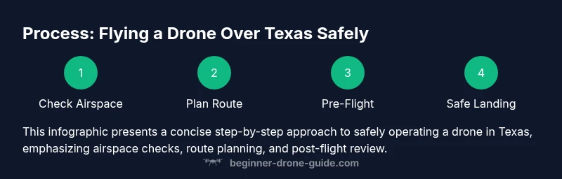
- 1
Check airspace & permissions
Before takeoff, verify the exact airspace class at your Texas location using FAA maps and LAANC if available. Identify any temporary restrictions and ensure you have the necessary permissions for sensitive areas. This step minimizes surprises and keeps you compliant.
Tip: Always verify NOTAMs and local rules for your exact spot in Texas. - 2
Check weather & wind conditions
Assess wind speed, gusts, visibility, and temperature. Texas weather can shift quickly, affecting drone stability and battery life. If conditions are unfavorable, delay the flight.
Tip: Prefer dawn or late afternoon when winds are calmer. - 3
Prepare the drone & controller
Charge all batteries, update firmware, calibrate compass away from metal and magnets, and verify GPS lock. Confirm that the return-to-home setting is accurate for your planned route.
Tip: Calibrate away from buildings and cars to avoid interference. - 4
Plan a safe flight path
Document takeoff point, intended route, altitude ceiling, and return-to-home point. Choose a conservative route that avoids crowds, airports, and critical infrastructure in Texas.
Tip: Save a map of your route and keep it accessible during the flight. - 5
Conduct takeoff & initial hover
Power on, perform a gentle takeoff, and hover at a stable altitude to verify controls and wind effects. Watch for drift and adjust as needed.
Tip: Keep the craft within line-of-sight at all times. - 6
Land & post-flight tasks
Land slowly, power down safely, and log flight data. Review footage for any anomalies and ensure you comply with privacy requirements and data handling rules in Texas.
Tip: Power off the drone before handling propellers.
Frequently Asked Questions
Do I need a license to fly a drone over Texas?
If you fly commercially, you need a Part 107 license; recreational flyers must follow FAA recreational rules and register if required. Always verify local Texas rules for specific cities or parks.
For most beginners, recreational flights follow FAA rules; if you plan to earn money, you need Part 107.
What airspace classes apply when flying over Texas?
Airspace around Texas can range from Class G to controlled classes near airports. Use FAA maps and LAANC for approvals where available, and avoid restricted zones.
Airspace near airports is restricted; check maps and get approvals before flying.
Are there parks or public spaces with drone restrictions in Texas?
Many state parks ban drones unless explicitly permitted. City parks may have rules too. Always check the official park or city regulations before launching.
Parks often restrict drones; verify rules with park staff or city authorities.
What should I include in a pre-flight checklist for drone over texas?
Battery status, firmware updates, GPS lock, compass calibration, propeller integrity, and return-to-home settings. Verify airspace and weather conditions.
Do a full pre-flight check: battery, GPS, compass, and airspace review.
How can I legally fly near airports in Texas?
Airspace near airports is restricted. Use LAANC or FAA waivers and follow official procedures for compliant operations near aviation facilities.
Airports require authorization; follow LAANC rules or obtain waivers before flights.
What about weather planning for drone flights in Texas?
Monitor wind, heat, and visibility. Texas heat can shorten battery life; fly in cooler parts of the day and be prepared to land if conditions worsen.
Weather affects safety and battery; plan for calm periods and monitor real-time conditions.
Watch Video
Quick Summary
- Check airspace before every flight
- Follow FAA rules and local ordinances
- Plan for weather and battery life
- Fly with line-of-sight and safe distances
- Obtain permissions for restricted zones before flights