Drone or Plane: A Practical Comparison for Beginners
A detailed, analytical comparison of using a drone versus a plane for aerial tasks. Learn differences in capability, cost, safety, licensing, and use cases to decide which platform fits your goals as a beginner.

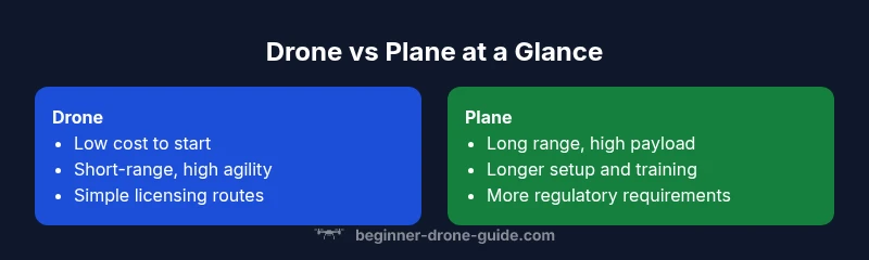
In most beginner and hobby contexts, a drone is the more practical choice over a plane for aerial tasks. Drones offer lower operating costs, easier licensing paths, and safer operation for short-range shoots and mapping. Planes win only when you need long-range coverage, heavier payloads, or true high-speed delivery of large surveys.
Framing the drone-or-plane decision for aerial tasks
When you ask, simply, drone or plane, the answer hinges on the scale of the project, the environment, and the required payload. For most beginners and hobbyists, a compact drone delivers the best balance of cost, ease of use, and safety. In this guide we explore how these two aerial platforms compare across core dimensions such as capability, cost, licensing, and use cases. Throughout, we’ll emphasize practical decision criteria that help you avoid over-investing in the wrong platform. According to Beginner Drone Guide, many newcomers underestimate the learning curve of piloting any aircraft, especially when you add regulatory considerations and flight planning. The goal is to empower you to choose confidently, experiment safely, and build skills that transfer as you expand your aerial toolkit. If your work frequently requires long range, heavy payloads, or sustained speed, you may ultimately lean toward a plane—but for the typical beginner project, starting with a drone is usually the right move.
Core capabilities: Drones vs Planes
When comparing drone or plane options, the core capabilities tell the story first. Drones excel at close-to-mid range flight with agile maneuverability, automated flight paths, and rapid deployment for photography, mapping, and inspection tasks. They typically rely on lighter payloads, simpler maintenance, and compact ground control systems that fit in a backpack. Planes, by contrast, handle longer flight durations, higher cruising speeds, and larger payload capacities, which makes them well-suited for large-area surveys, high-altitude photography, and significant payload transport. For beginners, the practical takeaway is to map each platform to a task profile: the drone fits short-range, high-detail needs; the plane fits long-range, mass data collection. The difference in flight characteristics also translates to planning: drone operations often stay within visual line of sight and local airspace, while planes require broader airspace awareness and more formal workflows.
Cost, licensing, and access for drone-or-plane work
Cost considerations drive early decisions about drone or plane use. A typical beginner drone offers a low barrier to entry with affordable hardware, widely available accessories, and consumer-friendly software for flight planning. The total cost is not just the hardware price but also batteries, maintenance, and training materials. Licensing and regulatory requirements for drones are generally clearer and more accessible for hobbyists and small commercial operators, though they vary by jurisdiction. Planes, even light sport or ultralight variants, usually involve higher upfront costs and more stringent regulatory requirements, including pilot certifications, airworthiness considerations, and more formal operating procedures. From a budgeting perspective, most beginners benefit from starting with a drone and a scoped project plan before expanding into heavier, more complex aviation options.
Performance and flight characteristics: speed, range, endurance, payload
Understanding the performance envelope is essential when choosing between drone or plane for a given task. Drones typically offer short-to-mid range flights with moderate payloads and highly flexible flight time depending on battery capacity. They are optimized for precise control and rapid repositioning, which is ideal for close-in photography, 3D mapping, and roof inspections. Planes deliver longer endurance and higher speeds, enabling broader area coverage in less time and the ability to transport heavier payloads such as larger survey sensors or mapping gear. The trade-off is higher complexity in launch, recovery, and maintenance, plus stricter airspace and weather constraints. For beginners, starting with a drone provides a safe pathway to develop piloting fundamentals before attempting the more demanding plane operations.
Safety, training, and risk management
Safety is a universal priority, regardless of whether you’re deploying a drone or a plane. Drones are managed with straightforward preflight checks, geofencing, and automated flight logs that help new pilots learn error handling. They also have robust safety nets for propeller protection and obstacle avoidance in many models. Planes require more formal flight training, weather assessment, airspace clearance, and ongoing maintenance to manage risk. The risk calculus shifts with scale: small drones present lower risk in typical urban or suburban environments, whereas planes demand more structured procedures for launch, flight, and landing. For beginners, investing time in a structured training plan—whether with a simulator, a certified course, or guided flights—pays dividends in safety and competence when you eventually expand to more capable aircraft.
Regulatory landscape and licensing for drone-or-plane use
Regulatory frameworks shape what you can do, where you can fly, and how you operate either platform. Drones commonly require registration and pilot qualification that can range from simple online tests to practical flight examinations, depending on your jurisdiction. Many regions offer streamlined pathways for hobbyists and small commercial operators, with evolving rules as technology and usage evolve. Planes bring a different regulatory burden, including pilot licensing, aircraft registration, maintenance standards, and more comprehensive airspace access procedures. For beginners, it’s essential to start with local guidelines, use authorized airspace, and keep up-to-date with regulatory changes that impact flight planning and data collection. Always document flights and maintain compliance records to reduce risk of penalties or flight disruption.
Practical use-case scenarios: photography, mapping, inspection, and more
The drone-or-plane decision often boils down to the intended application. A drone is typically the best choice for overhead photos, real-estate imaging, site surveys, and inspections of structures within a localized area. Its versatility is amplified by software that can stitch photos into maps, produce 3D models, or generate orthophotos with relative ease. A plane shines in scenarios that require high-altitude coverage, long battery life, or the ability to carry heavier sensors across large areas—think regional land surveys, forestry inventories, or power-line inspections that cover many miles. For beginners, starting with a drone refines skills and reduces risk while still enabling meaningful outcomes in a variety of tasks. As experience grows, you can pair drone data with occasional plane measurements for broader context.
Buying guide for beginners: choosing a platform, accessories, and planning
A beginner considering drone or plane should first define the project scope and learning goals. For drones, look for beginner-friendly models with robust safety features, reliable software, and clear maintenance guidance. Essential accessories include extra batteries, spare props, a landing pad, and a compact carrying case. For planes, assess the entry experience, including training availability, maintenance requirements, and the availability of safe launch/recovery methods. A practical plan starts with a single, well-scoped project, such as capturing a 2–5 acre site or creating a 3D model of a single building. As confidence grows, you can expand to more complex tasks or integrate data streams from multiple platforms to unlock new insights.
Real-world tests and decision heuristics: when to choose which platform
In real-world testing, the most reliable heuristic is alignment between task requirements and platform strengths. If the objective emphasizes speed, coverage area, or high-detail close-range data, a drone is typically the smarter choice. If the objective involves long-range coverage, large-area mapping, or heavy sensor payloads, a plane may be more efficient, albeit with a steeper learning curve and higher costs. Always run a pilot test in a controlled environment to validate your assumptions before scaling up. Keep a log of flight metrics and outcomes to compare against future projects. By documenting successes and missteps, you’ll build a decision framework that reliably guides subsequent use of drone or plane.
Common pitfalls and how to avoid them: practical tips for beginners
Avoid over-investing before defining a clear project scope; start with a single capability, such as basic aerial photography, to build confidence. Don’t neglect weather and wind considerations, which can devastate performance in either platform. Ensure your preflight checks are consistent, and use flight planning software to reduce human error. In the drone world, keep batteries topped up and practice takeoffs and landings in safe zones. For planes, secure appropriate training and certify all activities in line with regulations. By focusing on fundamentals and incremental growth, you minimize risk while maximizing learning and outcomes.
Comparison
| Feature | Drone | Plane |
|---|---|---|
| Typical operating environment | Urban/suburban, short to mid-range, tight spaces | Open areas, long-range, higher altitude |
| Endurance / flight time | Moderate to high depending on battery; rapid turnaround | Longer endurance with steady cruise; payloads influence time |
| Payload capacity | Light to moderate sensors; lightweight imaging packages | Heavier sensors and larger payloads; higher data throughput |
| Cost to acquire | Low upfront; affordable consumer models | High upfront; specialized aircraft and maintenance |
| Licensing and certification | Generally clearer for hobbyists and small commercial use | Stricter; pilot licensing and aircraft registration may apply |
| Maintenance and reliability | Lower maintenance, modular parts, frequent firmware updates | Higher maintenance standards, ground support, and parts availability |
| Best for | Close-range imaging, mapping, inspections, education | Large-area surveys, high-speed data collection, heavy payloads |
Benefits
- Low entry barrier for beginners with quick wins
- Safer operations in controlled environments
- Flexible software ecosystems and rapid data processing
Weaknesses
- Limited range and payload compared to planes
- Regulatory constraints can still apply (airspace, privacy)
- Battery swaps and maintenance can interrupt workflow
Drone wins for beginners; plane wins for long-range scenarios
Choose a drone to start: it’s more affordable, safer, and easier to learn. Consider a plane only when your projects demand long-range coverage or heavier payloads, and you’re prepared for higher complexity and licensing requirements.
Frequently Asked Questions
What is the key difference between using a drone and a plane for aerial imaging?
Drones excel at close-to-mid range imaging with rapid setup, flight planning, and lower risk. Planes provide longer endurance and higher-speed data collection for large areas, but require more training and regulatory work. Your choice should hinge on project scale and required data density.
Drones are great for small-area imaging and quick setup, while planes cover larger areas faster but require more training and compliance.
How do licensing requirements differ between drones and planes?
Drone licensing often focuses on operator competency and airspace rules, with relatively accessible pathways for hobbyists and small commercial work. Plane licensing typically involves pilot certification and aircraft registration, along with ongoing maintenance and operational standards.
Drones usually need operator training and airspace awareness; planes require formal pilot certification and aircraft oversight.
Are planes ever worth the extra complexity for beginners?
Planes are generally not worth the extra complexity for most beginners. They become advantageous when your work demands sustained long-range flights, very large coverage areas, or heavy sensors that drones can’t support. For most initial projects, a drone is the practical path.
Only if your projects demand long-range flight or heavy payloads; otherwise, start with a drone.
What are common safety concerns with drones and planes?
Drones require attention to battery management, propeller safety, and wind sensitivity in cluttered environments. Planes demand more formal flight planning, weather assessment, and airspace coordination to prevent conflicts with other aircraft and ensure safe operations.
Drones need battery and obstacle awareness; planes need weather checks and airspace coordination.
Can I transition from drone work to plane work later on?
Yes. Start with a drone to gain foundational flight skills and data collection practices. As you identify needs for longer-range data or higher throughput, invest in training and regulatory compliance for planes, while gradually integrating data from both platforms.
Start with a drone, then scale up to planes as your projects demand it.
What should beginners consider when planning a real estate shoot?
For real estate, a drone is typically sufficient for exterior and interior tours with aerial context. Consider flight time, weather windows, and local rules on privacy. If the property is particularly large or complex, a plane may only be necessary for supplementary data coverage.
Drones usually cover real estate needs; planes are rarely required unless the footprint is very large.
Quick Summary
- Assess project range and payload before choosing
- Start with a drone to build piloting skills
- Plan for licensing and safety early in the process
- Use pilots’ logs to improve decision-making
- Scale up to planes only when justified by needs