Where to Fly a Drone Near Me: A Practical Beginner's Guide
Discover safe, legal spots to fly your drone near you. This beginner-friendly guide covers airspace basics, permissions, etiquette, and real-world tips to fly smarter and stay compliant.

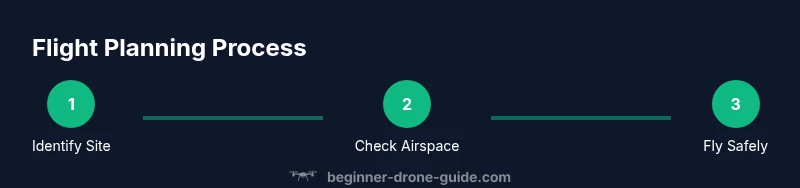
In short, you’ll accomplish safe, legal drone flights by choosing public, open spaces, checking airspace rules, and obtaining any required permissions before you lift off. Start with a local airspace map, confirm privacy and weather conditions, and fly conservatively to build confidence and stay compliant. This step-by-step approach minimizes risk and helps you practice responsibly.
Why Location Matters When Flying Near Me
If you’ve asked yourself, where to fly a drone near me, the answer begins with location. The site you choose affects airspace eligibility, privacy expectations, weather exposure, and proximity to people or property. According to Beginner Drone Guide, starting with a safe, low-risk site is the fastest way to build confidence and avoid legal trouble. In practice, look for wide, open spaces with clear sightlines, away from crowds, roads, schools, and critical infrastructure. Public parks, open fields, and rural areas often provide the most reliable starting points, provided local rules allow drone operations. Always assess potential hazards like power lines, trees, and unpredictable gusts, and have a clear return plan in case conditions shift. By prioritizing location first, you set a solid foundation for every flight and reduce the need for last-minute improvisation.
Understanding Airspace and Permissions
Airspace around you is divided into zones with varying rules. Before you fly, consult official airspace maps, local notices, and any platform-specific guidance. Beginner Drone Guide analysis shows that most beginner flights occur outside controlled airspace or within zones that permit operations with minimal authorization. If you’re near airports, stadiums, or industrial facilities, expect tighter restrictions or a required authorization process. Even in seemingly open spaces, temporary restrictions can apply during events or emergencies. The moment you identify a potential site, cross-check the airspace classification, vertical limits, and any no-fly indicators. If permission is required, follow the official channels and document your approval. Treat every flight as if the airspace could change, and plan alternatives in case access is suddenly revoked.
Choosing Legal Outdoor Spots
Legal spots share several common traits: they’re open, low-traffic, and permit recreational drone use under current regulations. Start by verifying park rules or municipal ordinances, and look for designated drone-friendly zones if available. Private property can also be a good option with explicit permission from the owner. When evaluating a site, consider audience risk (people, pets, and vehicles), wildlife disruption, and the potential for privacy concerns. Ethical flying means avoiding sensitive facilities, respecting property boundaries, and notifying nearby residents if your flight may be audible or visible. By prioritizing permission, visibility, and minimal disruption, you’ll experience smoother flights and fewer conflicts with bystanders or authorities.
Tools, Apps, and Checklists You Need
A reliable drone pilot uses a small set of tools to stay compliant and confident. Before launch, ensure you have a charged drone, a controller, and a smartphone or tablet with your flight app. Keep an up-to-date airspace map or app that reveals current classifications and temporary restrictions. A basic weather checklist helps you assess wind, precipitation, and visibility. Don’t forget a simple logbook to record flight date, location, conditions, and any deviations from plan. These tools contribute to safer flights and faster learning, especially for beginners who are building a routine.
Pre-Flight Checks and Safe Flight Habits
Preparation is the heart of safe flying. Do a quick exterior inspection of propellers, frame, and gimbal; verify compass and IMU calibration if your drone requires it; and confirm GPS lock. Establish a conservative altitude and maintain line of sight at all times. Set return-to-home or land-at-circle parameters in case control is lost. During the flight, keep a mental or visible flight boundary and watch for people and animals entering the operation area. A strong habit is to perform a hover test at a low altitude before attempting any complex maneuvers. By building a consistent pre-flight routine, you’ll minimize surprises mid-flight and gain confidence faster.
Real-World Scenarios: Safety, Etiquette, and Privacy
Real-world flights often involve negotiating parking lot activity, family picnics, or street traffic. In such cases, select routes that minimize overflight of people and avoid sensitive moments or private property. A courteous approach includes informing nearby property owners if you plan a longer session near their home or business, and always yielding to observers who request you to stop or land. Weather can shift quickly, so have a plan B for shade, wind shelter, or a quick landing. These practical considerations—privacy, etiquette, and weather awareness—help you fly better and stay on the right side of local norms and laws.
Tools & Materials
- Drone with charged battery and propellers checked(Calibrate compass and ensure firmware is up to date)
- Controller and mobile device(Have the flight app installed and ready)
- Airspace maps / flight planning app(Check current classifications and NOTAMs)
- Weather check tools(Wind, visibility, and precipitation assessment)
- Notepad or digital logbook(Record flight details and observations)
- Sunscreen and water(Stay comfortable during longer sessions)
Steps
Estimated time: 30-60 minutes
- 1
Identify a safe location
Scan the area for open space away from crowds, roads, and sensitive facilities. Confirm there are no temporary restrictions and plan a clear takeoff and landing path. Decide on an easy, repeatable flight area to reduce decision fatigue during the run.
Tip: Select a spot with long sightlines and firm footing for quick takeoff and landing. - 2
Check airspace and permissions
Open your airspace map or flight app and verify the classification of your chosen site. If the area lies within controlled airspace or a restricted zone, obtain the necessary authorization before launch. If no permission is required, document your check in your flight log.
Tip: If permission is required, start the process early to avoid last-minute denials. - 3
Check weather and wind
Read local weather forecasts and observe wind at ground level. Confirm visibility is adequate for safe flight and avoid flying in gusty or shifting wind. If conditions drift, pause the flight and reassess.
Tip: Never fly in rain or poor visibility; have a plan to land quickly if wind shifts. - 4
Pre-flight calibration and checks
Inspect the drone frame, propellers, and motors for damage. Calibrate sensors if required and ensure GPS lock before takeoff. Review battery levels and set a conservative hover test at a safe altitude.
Tip: A quick hover test helps verify stability before moving to more complex maneuvers. - 5
Plan your flight path and altitude
Outline a simple, repeatable route that minimizes overflight of people. Set an altitude baseline that keeps you clear of obstacles and within recommended limits. Consider a return-to-home point in case you lose control.
Tip: Keep your route simple at first; complexity can escalate risk quickly. - 6
Execute a controlled takeoff and hover
Lift smoothly to your planned altitude and hover to verify stability in the actual environment. Use smooth, deliberate movements and avoid rapid, jerky controls. Watch for any drift or interference from nearby structures.
Tip: Hold the controller lightly and keep fingers ready to intervene if anything feels off. - 7
Land, log, and review
Return the drone to a safe landing, power down, and log key details: site, weather, observed issues, and battery consumption. Reflect on what could be improved for your next session and note any privacy or etiquette concerns.
Tip: A quick post-flight review builds your learning loop and reduces repeat mistakes.
Frequently Asked Questions
What is the easiest way to find legal flying spots near me?
Start with official airspace maps and local park rules, then confirm any event-specific restrictions. If in doubt, choose a widely open area and plan alternatives.
Use official airspace maps and park rules to locate legal spots, and always have backup locations ready.
Do I need permission to fly near airports?
Yes. Flying near airports usually requires authorization through official channels. Avoid these zones unless you have explicit approval.
Airports are highly restricted; obtain permission or pick a different location.
Can I fly in public parks with my drone?
Many parks allow recreational drones in designated areas or under specific conditions. Always check posted rules and maintain safe distances from people and wildlife.
Check park signs and local rules; keep safe distances and follow posted guidelines.
What should I do if someone asks me to land or stop flying?
Respect the request, land safely, and discuss later if appropriate. Clear communication helps prevent conflicts and keeps you compliant.
If someone asks you to land, do so calmly and comply to keep the situation safe.
How can I stay updated on evolving drone regulations?
Regularly check official aviation authorities, local city ordinances, and reputable guides. Join community groups to learn from ongoing experiences and changes.
Keep up with official sources and trustworthy guides for the latest rules.
What happens if I violate drone rules?
Consequences vary by jurisdiction but can include fines, flight restrictions, or legal action. Always prioritize compliance and seek guidance if unsure.
Violations can lead to fines or license issues; stay informed and compliant.
Watch Video
Quick Summary
- Plan the flight area before you go.
- Verify airspace rules and permissions.
- Check weather and wind conditions.
- Maintain privacy and comply with local laws.