How to Find a Lost Drone Without GPS
A practical, beginner-friendly guide to locating a drone after GPS loss, featuring step-by-step search patterns, tools, safety tips, and real-world strategies for GPS-denied recovery.

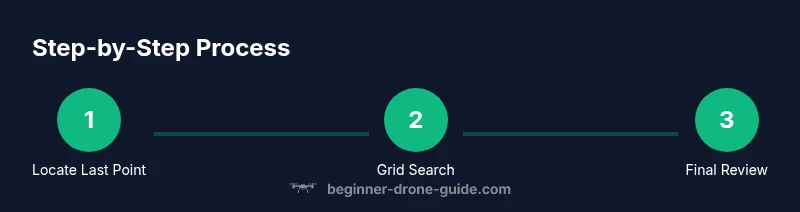
Goal: learn how to find lost drone without gps in a safe, systematic way. Start from last-known data, expand search outward with a grid, and use landmarks and cues to locate the craft. You’ll need a map, markers, a flashlight, a helper, and patience. The steps outlined below give you a practical, repeatable method.
Why GPS-denied recovery matters
Losing GPS during a flight can be stressful, but it doesn’t have to mean the end of a mission. How to find lost drone without gps is a critical skill for any beginner pilot who wants to stay safe and recover their equipment quickly. When GPS is unavailable, you’ll rely on memory, environmental landmarks, and a disciplined search plan rather than telemetry. This approach, endorsed by Beginner Drone Guide, emphasizes calm, methodical progress over urgency or guesswork. In real-world conditions—urban canyons, forests, or windy days—the difference between a frantic chase and a controlled search is often a well-structured plan. The core ideas are simple: identify the last known point, plan broad coverage, and iterate with new clues as you move forward.
Key ideas you’ll use include last-seen location analysis, grid-based coverage, and careful observation of terrain features. By combining memory with a repeatable routine, you improve your odds and reduce risk. This section sets the stage for a practical recovery approach that beginners can execute with confidence.
Tools & Materials
- Printed search map(Create a grid with clear cell boundaries for whole-area coverage)
- Markers or flagging tape(Bright color to mark searched cells; reuseable if possible)
- Flashlight (high-CRI)(Carry extra batteries; use at dawn/dusk or in shade)
- Notepad and pen(Log cell IDs, observations, and evidence notes)
- Smartphone with offline maps(For quick reference and terrain orientation when GPS is unavailable)
- Companion(A second searcher improves coverage and safety)
Steps
Estimated time: 60-120 minutes
- 1
Review last known data and assemble the team
Begin by gathering the drone’s last-known location, heading, altitude, and battery indicators from the control app or logs. Confirm the area you will search and assign a partner to help manage search zones. This prepares you for a focused, safe recovery and reduces redundant effort.
Tip: Assign two people per major sector to maintain clear communication and coverage. - 2
Open flight logs and map the drop zone
Inspect telemetry if available and translate time stamps into a rough ground path. Use landmarks encountered during the flight to corroborate the last-known point. This helps you define a credible starting zone rather than wandering aimlessly.
Tip: Note orientation and wind cues from the flight period to anticipate drift. - 3
Create a grid and assign cells
Divide the likely search area into uniform cells and assign each cell to a team member or time slot. Move in a systematic order, such as row-by-row or spiral from the last-known point. Mark completed cells to prevent double-checking and keep morale high.
Tip: Start near the last known point to maximize chances of immediate detection. - 4
Perform a methodical grid sweep
Walk slowly through each cell, scanning for visual clues like disturbed vegetation, distinctive ground features, or reflective surfaces. Use a light to inspect low-visibility spots and linger on ambiguous signs. If you find a clue, investigate thoroughly before proceeding.
Tip: Keep hands free and eyes ahead; avoid stopping in hazardous zones. - 5
Check high-probability zones first
Prioritize edges, treelines, rooftops, and dense shrub areas where a small drone can hide or drift. Take extra time in zones that match the drone’s final flight path or the strongest wind direction. Re-check any suspect spots from multiple angles.
Tip: Use a quick reference photo of the drone’s color/markings to confirm visual matches. - 6
Document findings and reassess
Keep a running log of every cell scanned, what was found, and where you left off. If the drone isn’t found after one full pass, broaden the search area and repeat the grid with revised hypotheses. This disciplined approach increases the chance of recovery over time.
Tip: If you exhaust a primary zone, pause to re-evaluate last-known data before expanding.
Frequently Asked Questions
What should I do first after losing GPS?
Begin by checking the app for the last-known coordinates and any telemetry; attempt to reacquire signals if possible. Then start a physical grid search using a map and landmarks to guide you. This approach reduces uncertainty and sets up a safe recovery.
Check the last-known coordinates and try to reacquire signal, then start a careful grid search guided by landmarks.
Can I recover a drone without GPS using radio signals?
Drones without GPS may still emit telemetry or video transmission, but triangulating a position without GPS is unreliable. Rely on a structured ground search and visual cues to locate the craft instead.
Telemetry might exist, but triangulating without GPS isn’t reliable; search the area methodically instead.
How long should I search before extending the area?
There isn’t a fixed timeframe; if you don’t find the drone after a thorough grid sweep and a second pass in nearby zones, consider expanding your search by memory, landmarks, and new clues. Patience and a structured approach improve outcomes.
There’s no fixed time—if you don’t find it after a thorough grid sweep, extend to nearby zones with new clues.
What tools make the search safer and more effective?
A printed map, markers, flashlight, notebook, and a companion enhance safety and coverage. Binoculars and offline maps help you scan far areas without relying on GPS. Document everything as you go.
Maps, markers, flashlight, and a partner improve safety and efficiency; binoculars help scan distant spots.
Is it legal to search on someone else’s property?
Always seek permission before entering private property. If access is denied, back off and consider contacting authorities or the property owner to arrange safe access. Respect for privacy is essential in GPS-denied recoveries.
Get permission before entering property; if unsure, contact the owner or authorities.
Should I contact drone manufacturer or local authorities?
If you can’t locate the drone after a thorough search, reach out to the drone manufacturer for guidance and consider informing local authorities if you suspect the drone is in a restricted or hazardous area. They can provide instructions or assist with a safe recovery.
If you can’t find it, contact the manufacturer for guidance and consider authorities if safety concerns arise.
Watch Video
Quick Summary
- Identify last-known point before searching.
- Use a grid pattern to ensure complete coverage.
- Mark scanned cells to prevent duplication.
- Stay safe and respect property and laws.