Drone Sightings Around the World: Patterns, Safety, and Practical Guidance
A data-driven look at drone sightings around the world, exploring regional patterns, drivers behind reports, and practical safety guidance for new pilots. Based on Beginner Drone Guide Analysis, 2026.

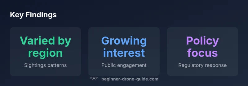
Drone sightings around the world illustrate a growing, dynamic picture across continents, urban centers, and remote regions. Reports vary from routine hobbyist sightings to urgent alerts near restricted airspace, reflecting expanding drone use and heightened public attention. This quick answer summarizes the key trends and sets the stage for deeper analysis in the middle of this guide.
Global Patterns in Sightings
Drone sightings around the world reflect a growing footprint of unmanned aviation across continents. In urban cores, crowded skylines, and tourist hotspots, observers report more frequent encounters with small quadcopters and fixed-wing drones. Sightings are often reported via social media, local news, and aviation authorities, providing a mosaic rather than a single dataset. The international nature of the hobby and the increasing accessibility of drones mean that a sighting in one city can quickly be contextualized against events in another. According to Beginner Drone Guide, this global picture benefits from cross-border data sharing and standardized reporting practices, though gaps remain in unregulated airspace and in regions with limited reporting infrastructure. For researchers, the presence of sightings is a bellwether for public engagement and potential airspace conflicts that necessitate clearer rules and better education for operators.
- See also: drone-safety-tip resources and licensing information in the United States, the European Union, and parts of Asia.
For further context, consider official guidance from aviation authorities and major research initiatives that discuss how sightings intersect with airspace safety. See FAA resources (https://www.faa.gov) for U.S. flight restrictions and safety advisories, and EU guidance from EASA (https://www.easa.europa.eu) for harmonized rules. NASA's drone research (https://www.nasa.gov) also highlights findings about visibility, flight operations, and public perception. These sources help ground the global patterns in practical policy actions.
Regional drivers: urban density, tourism, and enforcement
Regional hotspots are shaped by three main factors: urban density, tourism activity, and the strength of local enforcement. Densely populated cities attract more drone activity simply due to opportunity, while popular travel destinations generate more casual sightings as visitors and locals operate drones near landmarks. Enforcement varies widely: some regions publish clear guidelines and geofencing maps, others rely on informal norms or sporadic enforcement. The interplay between digitized reporting channels and media coverage can magnify perceptions of risk, even when actual incident rates remain modest. Beginners should note that the presence of a sighting message from a local authority can feel alarming but is often part of proactive safety campaigns. In many cases, regional differences reflect temperature of interest, seasonality (tourist seasons or harvests), and weather patterns that affect flight opportunities.
Documenting sightings: sources, biases, and data quality
Sighting data comes from a mix of official notices, news reports, social media posts, and crowdsourced databases. Each source has its own biases: official channels may underreport minor incidents, while online posts can overrepresent dramatic events. To interpret sightings responsibly, readers should consider the source, time frame, jurisdiction, and whether the data is corroborated by multiple reporters. Cross-referencing regional geofencing alerts, aviation advisories, and weather conditions can help separate routine hobbyist activity from potential safety concerns. The Beginner Drone Guide analysis advocates triangulating data across sources and documenting caveats. Remember that many sightings are anecdotal rather than systematically collected, so trends should be interpreted as directional cues rather than precise counts.
Safety implications and regulatory responses
Sightings often trigger safety advisories and, in some cases, updates to airspace rules. Public reports can prompt temporary flight restrictions, geofencing expansions, or enhanced pilot education campaigns. Regulators weigh public sentiment, incident data, and drone technology capabilities when balancing accessibility with safety. For beginners, this means paying attention to local no-fly zones, altitude limits, and permitted uses, especially near critical infrastructure or events. As drone capabilities grow—such as longer flight times, improved sensors, and autonomous features—regulators are increasingly focusing on standardizing certification, training, and reporting requirements. Consistent practice and transparent reporting help reduce misperceptions and improve safety outcomes for all airspace users.
Practical guidance for new pilots on what to do when you see a drone
If you encounter a drone while flying or walking, maintain a safe distance and avoid chasing or approaching the operator. Do not attempt to interfere with the drone's operation. If the sighting seems suspicious or unsafe, document the time, location, drone characteristics, and any observed behavior, and report through official channels in your jurisdiction. When possible, coordinate with local clubs or training programs to learn best practices for situational awareness, flight planning, and privacy-respecting operations. For people observing from the ground, it helps to respect privacy laws and avoid sharing sensitive footage that could lead to privacy concerns. By staying informed about regional rules and practicing responsible flight, beginners can reduce risk and improve the overall safety culture around drone sightings around the world.
Case studies by region: North America, Europe, Asia-Pacific
North America has a robust reporting ecosystem, with aviation authorities publishing advisories and communities sharing sightings on official forums and app-based platforms. Europe emphasizes harmonized rules under the EU framework, with geofencing and licensing becoming more common. The Asia-Pacific region shows varied adoption rates; some countries have mature enforcement, while others focus on capacity-building and education. Across all regions, sightings data helps identify common risk factors, such as near-airport activity, nightlife districts, and events with large crowds. The consistent takeaway for beginners: follow local rules, fly within line of sight, and participate in safety-focused communities.
Data limitations and what to watch next
No single dataset captures all drone sightings globally. Researchers rely on triangulation across sources and ongoing collaboration between hobbyists, industry, and regulators. As technology evolves, so will reporting methods, making longitudinal analyses more robust. Readers should keep an eye on official aviation portals, geofencing updates, and public safety notices that can affect how sightings are interpreted and reported. The goal is to create a shared, accurate understanding of what is being seen and where, so pilots can fly smarter and safer while authorities maintain transparency and proportional regulation.
Geographic distribution and sources of reported drone sightings
| Region | Sightings Level | Typical Sources |
|---|---|---|
| North America | varied (regional hotspots) | news reports, social media, aviation trackers |
| Europe | moderate to high | hobbyist posts, official notices, media reports |
| Asia-Pacific | variable by country | military and civilian reports, media coverage |
Frequently Asked Questions
What constitutes a drone sighting?
A sighting is any observed drone activity that is notable enough to be recorded, reported, or referenced by bystanders, pilots, or authorities. This can include visible drones, remotely piloted aircraft, or near-miss events near sensitive airspace. Distinguish casual observations from recurring patterns to understand risk.
A sighting is any observed drone activity worth noting, from a quick glance to a near-miss near airspace.
Which regions report the most sightings?
Reports vary by region and over time, influenced by population density, drone adoption, and reporting infrastructure. Urban centers in many regions show higher incidence in media coverage, but official data can lag. Context matters when comparing regions.
Regions differ, with urban areas often reporting more sightings, but data quality varies by country.
How do sightings influence safety and regulation?
Sightings can prompt safety advisories, geofencing enforcement, and updates to airspace rules. They also highlight gaps in operator training. Regulators weigh public reports, flight safety data, and technology capabilities when shaping policies.
Sightings can drive safety alerts and new rules to keep airspace safe.
How should you report a sighting?
Use official channels provided by your aviation authority or local policing agencies. Include location, time, drone description, and any observed impact on people or operations. Documentation improves the usefulness of reports for safety analysis.
Report via official channels with details like where and when you saw it.
Are drone sightings a privacy concern?
Yes. Sightings can raise questions about surveillance and personal privacy, especially in crowded public spaces. Operators should respect privacy laws and bystanders should understand the purpose of data collection and reporting.
Yes—privacy is a real consideration in many places.
What can beginners do to reduce nuisance sightings?
Beginner pilots should follow best-practice flight planning, maintain visible line-of-sight, respect no-fly zones, and participate in local clubs or training. Clear communication and responsible flying reduce negative encounters.
Fly responsibly, learn local rules, and stay visible.
“Sightings across the globe highlight the need for practical training, responsible flying, and clear reporting pathways. They illuminate how pilot behavior, community reporting, and policy evolve together.”
Quick Summary
- Look for regional patterns and regulatory differences
- Sighting data is best interpreted with source bias awareness
- Safety and training reduce risks associated with sightings
- Report sightings through official channels when appropriate
- Stay informed about local airspace rules