How Drones Can Be Used in Construction: A Practical Beginner's Guide
Discover practical, beginner-friendly ways drones enhance surveying, safety, scheduling, and asset management on construction sites. Learn data workflows, compliance basics, and how to scale a drone program.

Drones can be used in construction to streamline surveying, inspection, progress tracking, and safety management. They capture high-resolution aerial imagery, 3D models, and volumetric data that help teams plan, monitor, and decide quickly. By reducing manual climbs and on-site time, drones improve accuracy and safety while cutting costs over the project lifecycle. According to Beginner Drone Guide, proper flight planning and data processing are essential to maximize results.
The strategic value of drones on construction sites
According to Beginner Drone Guide, drones provide a strategic lens on complex sites. They enable rapid data capture across large footprints, minimize on-site risk, and support better communication with stakeholders. For project managers, the ability to see a site from above translates into earlier detection of clashes with planned layouts and faster approvals from design teams. The ultimate payoff is more predictable schedules and improved safety culture. When teams adopt repeatable data collection cycles, they build a reliable evidence trail for decision-making across design, procurement, and construction phases.
In answer to 'how can drones be used in construction,' the practical answer is to deploy them across surveying, progress tracking, and safety checks. The data you collect—imagery, 3D models, and volume measurements—serves as a single truth source. The value comes from how you interpret and act on that data, not merely from collecting it. This is why planning the data workflow early matters.
Key use cases in detail
Drones serve multiple roles on construction sites, from initial reconnaissance to ongoing QA checks. For beginners, think of drones as a scalable sensor network that complements ground crews. They help you map elevations, track stockpile volumes, monitor equipment locations, and document QA milestones. With clear flight rules and standardized data formats, your team can produce repeatable deliverables that stakeholders understand. Over time, this consistency reduces rework and accelerates approvals, making the project more transparent and collaborative.
Surveying and topographic mapping
High-quality aerial imagery and point clouds enable accurate topographic maps without manual site visits. Drones generate dense surface models that feed into design and BIM workflows, improving clash detection and alignment checks early in the project. For new crews, investing in stable platforms, proper calibration, and ground control points yields reliable results. Remember to plan flights for consistent overlap and capture multiple altitude levels for a robust model. This data is especially valuable during site leveling and road or trench design phases.
Progress tracking and scheduling integration
Regular drone flights at defined milestones create a visual tape measure of progress, supporting earned value tracking and schedule forecasting. When integrated with BIM or project management software, the data translates into monthly or weekly progress reports, surfacing deviations sooner. Teams that maintain a consistent cadence can forecast completion dates more accurately and flag potential delays before they impact critical path activities. Clear visualization of progress helps non-technical stakeholders stay informed and aligned.
Safety inspections and hazard detection
Drones enable inspectors to reach difficult zones, such as tall facades, roofs, or hazardous equipment, without exposing workers to risk. They capture thermal imagery for equipment health checks, detect slope movements, or surface defects that might indicate water intrusion or structural concerns. Establish safe flight corridors and preflight checklists to avoid near-misses. On busy sites, drones can replace risky rope-access or scaffold-based tasks with safer, repeatable inspections.
Asset management and inventory
Maintaining an up-to-date inventory of materials, tools, and equipment reduces waste and theft while improving site logistics. Drone surveys can verify stockpile levels, material delivery sequences, and equipment locations. Pair drone data with a simple asset tagging system and a central database to streamline audits and reduce delays caused by misplaced items. Regular checks ensure the project uses the right resources at the right times, supporting lean construction principles.
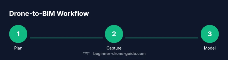
Data workflow: capture to BIM
A coherent data workflow starts with flight planning, data capture, and standardized processing. Convert raw imagery into georeferenced products such as orthomosaics and 3D models, then import these into BIM environments to compare with design intent. Align coordinate systems with design models to measure deviations and guide rework decisions. Establish naming conventions, storage standards, and access controls so the team can find, share, and reuse data across workflows. This interoperability is what turns flight data into actionable insight.
Implementation in common project phases
From site survey during procurement to as-built documentation at handover, drones adapt to project phases. Early on, use them for site feasibility studies and order-of-magnitude forecasts; mid-project, track progress against schedule; late-stage, document as-built conditions for handover and maintenance planning. Educate team members on data expectations, ensure pilots have appropriate training, and set up a centralized data portal. A phased approach reduces risk while providing value from day one.
Safety, privacy, and regulatory considerations
On any construction site, safety remains top priority. Develop flight permissions, maintain line-of-sight operations where required, and implement geofencing to keep drones within authorized areas. Train pilots on risk assessment, weather thresholds, and emergency procedures. Respect privacy and local regulations by sharing a basic policy with workers and visitors. Regular audits of compliance, data retention policies, and equipment maintenance keep the program sustainable and trusted.
Roadmap for teams: scaling drone programs
Begin with a pilot in a single project to refine data formats, flight cadence, and stakeholder communication. As the team gains confidence, expand to multiple sites, standardize data templates, and automate repetitive processing tasks. Invest in training and a culture of safety, while continuously evaluating new sensors or software that enhance value. The goal is a scalable, repeatable program that delivers measurable improvements in time, cost, and quality.
Tools & Materials
- Drone with integrated high-resolution camera(Ensure stabilization and GPS for accurate georeferencing)
- Extra batteries and chargers(Plan battery warm-ups and consider hot-swappable packs)
- Ground control points (GCPs) and surveying equipment(Useful for precise mapping; optional for many sites)
- Tablet or laptop with processing software(For on-site quick processing and data review)
- Memory cards and data storage(Carry multiple fast cards; back up frequently)
- Weather monitoring tools(Check wind, humidity, and precipitation before flights)
- Flight planning software or maps(Helps optimize flight paths and overlaps)
- Personal protective equipment (PPE)(If required by site safety policies)
Steps
Estimated time: 2-3 hours
- 1
Define objectives and data needs
Clarify what project goals the drone data will support (e.g., site surveys, progress tracking, or safety checks). Establish acceptable data formats and frequency to meet stakeholders' needs.
Tip: Tie data collection to a measurable project milestone to justify each flight. - 2
Obtain permissions and train the team
Ensure pilots are certified if required and that the site has authorization to fly. Provide basic training on safety, data handling, and reporting standards.
Tip: Create a preflight checklist covering weather, airspace, and emergency procedures. - 3
Plan flights and capture data
Develop a flight plan with routes, overlap, and altitude. Schedule flights to minimize disruption, and decide data outputs (orthomosaics, point clouds, etc.).
Tip: Use consistent flight heights and overlaps for easy comparison over time. - 4
Process data and store securely
Process raw imagery into usable products; store on a centralized server with proper backups. Maintain clear naming conventions and metadata for traceability.
Tip: Back up data in at least two locations to prevent loss. - 5
Integrate with BIM and project management
Import processed data into BIM tools and link to project schedules. Create dashboards that visualize progress against the baseline design.
Tip: Sync data at defined intervals to keep models current. - 6
Review results with stakeholders
Share visualizations with designers, contractors, and clients. Use findings to guide procurement decisions and schedule adjustments.
Tip: Encourage feedback from users to improve data quality. - 7
Scale the program thoughtfully
Expand coverage to new sites and standardize templates. Invest in ongoing training and explore automation for repetitive tasks.
Tip: Pilot new sensors or software on a controlled site before broad rollout.
Frequently Asked Questions
Can I use a consumer drone for construction work?
Yes, for basic tasks like quick site views, but professional data quality, safety training, and regulatory compliance are recommended for meaningful construction workflows.
A consumer drone can work for simple tasks, but for real construction data you’ll want proper training and compliance.
What data formats do construction drones capture?
Drones produce high-resolution imagery, orthomosaics, and 3D point clouds. These outputs feed into GIS and BIM pipelines and support progress tracking and design validation.
They capture images, 3D models, and maps that feed BIM and GIS tools.
Do I need a license to fly a construction drone?
Regulatory requirements vary by country. In many regions, commercial flights require certification and registration, plus adherence to airspace rules and safety protocols.
Regulations differ by country; many places require certification for commercial flights.
How often should flights be scheduled on a project?
Schedule flights around key milestones and weather windows. Regular cadence improves visibility, supports earned value management, and reduces surprises as the project evolves.
Schedule flights with milestones to track progress and catch issues early.
What are common challenges starting a drone program?
Safety concerns, data management, and team adoption are typical hurdles. Start with a pilot project, define data standards, and invest in training to reduce risk.
Challenges include safety, data handling, and getting the team on board.
What safety steps are essential on-site?
Establish flight zones, perform preflight checks, maintain line-of-sight when required, and have an emergency plan. Regular reviews keep practices current and safe.
Set zones, run checks, and have an emergency plan for safe flights.
Watch Video
Quick Summary
- Define clear data goals before every flight
- Use drones to complement, not replace, on-site teams
- Integrate data with BIM for better design-to-construction alignment
- Pilot safety and regulatory compliance are essential for success
- Scale gradually with standardized templates and training